Synthesizing and visualizing data for science engagement and conservation insights
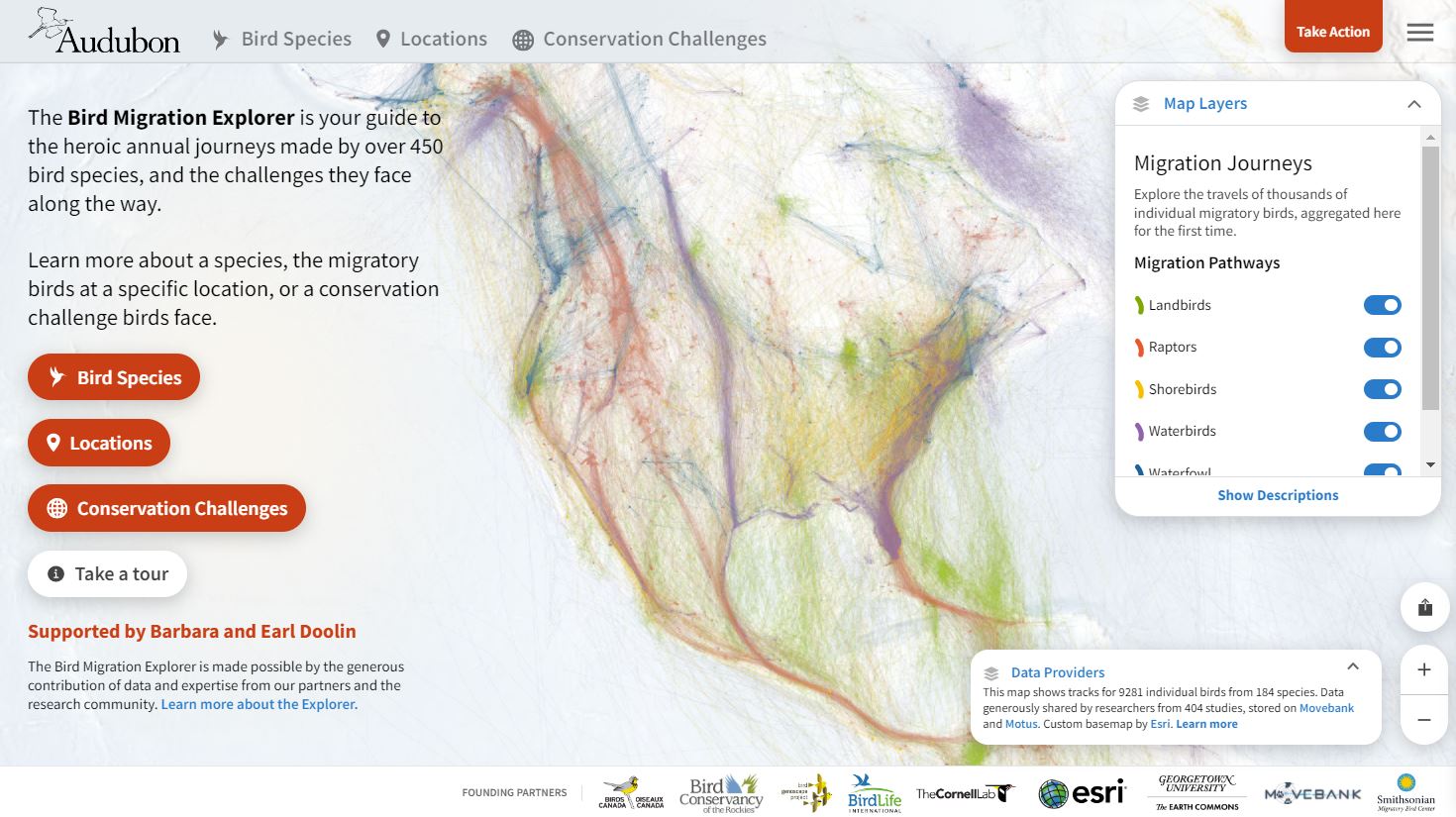
Bird Migration Explorer
Led the design and build of the Bird Migration Explorer—a geospatial web application that engages audiences and provides unique insights through visualization of bird migration patterns, connections, and conservation challenges for 450 species across the Western Hemisphere. Behind the Explorer is a large and complex interoperable system of spatial and quantitative data synthesized from contributions by nearly 300 research institutions. We developed the product in partnership with ten major science, technology, and conservation organizations. The Explorer is visited by hundreds of thousands of users each year and has been widely used for applications in conservation, research, education, engagement, and advocacy.
Ship-board Lecturing
Spent three weeks aboard the private residential yacht The World as an Alaska ecology lecturer. Developed a series of six 45-minute lectures for an astute, well-traveled audience curious about the natural history, ecology, conservation, and environmental policy aspects of the state. Led onshore birding walks. Lecture topics included:
Ecology and Conservation in the World’s Largest Intact Temperate Rainforest
This presentation is a foundational overview of the ecology, natural history, and conservation priorities of the Tongass—the world’s largest remaining intact temperate rainforest. We’ll examine the system from global context to local management realities, including why much of the landscape is not high-value, accessible timber despite its vast scale. You’ll learn to recognize the ecological differences between structurally complex old growth and simplified second growth, and why those differences matter for salmon, deer, wolves, bears, and forest birds. We close with the long footprint of logging and roads, the role of fisheries and tourism in regional economies, and a scientific conservation strategy focused on the 77 most important watersheds. Available here.
Migration Journeys: Where Alaska’s Birds Go and How We Know
Have you ever wondered where your backyard birds spend the winter—or what they experience on their long flights back each spring? Join us for an eye-opening exploration of Alaska’s migratory birds as we follow their remarkable journeys across the hemisphere. In this presentation, we’ll dive into the cutting-edge technologies that scientists use to track bird movements, from tiny geolocators to satellite transmitters. We’ll discover how these data reveal surprising patterns, highlight the challenges birds face along the way, and deepen our understanding of migration at both local and global scales. Available here.
Making Southeast Alaska: How Rock and Ice Became a Rainforest
Southeast Alaska is a landscape born from extremes—ancient bedrock forged in distant oceans, mountain ranges uplifted by colliding plates, and vast glaciers that carved fjords and shaped the coast. As the ice retreated, life surged in, transforming barren rock into one of the world’s richest temperate rainforests. This talk explores the geologic forces, repeated glacial advances, climate refugia, and waves of wildlife colonization that built today’s vibrant ecosystems. We’ll also look at how Southeast Alaska continues to evolve through glaciers, landslides, climate change, and human influence—a dynamic landscape still very much in the making. Available here.
From Pixels to Policy: Using Maps to Influence Wildlife Conservation
How do we translate millions of scientific observations into meaningful conservation outcomes? This talk explores the geospatial science powering wildlife conservation, from satellite trackers to citizen science. Discover how birds serve as environmental sentinels, and what tracking data reveal. We’ll examine how spatial analysis identifies core wildlife habitat areas, quantifies population exposure to threats, and prioritizes conservation action. Through real-world examples of conservation applications grounded in robust spatial analysis, learn how GIS, ecological knowledge, and data visualization transform raw information into actionable priorities and enduring protections for critical habitats. Available here.
The Global Importance of Alaska’s Arctic Seas
Though remote on the map, Alaska’s Arctic waters are among Earth’s richest marine systems. The moving ice edge drives spring blooms and benthic nutrient stores that feed walrus, bowhead whales, and vast seabird colonies. This extraordinary productivity also powers human food systems, including the world’s largest wild salmon fishery. From enduring hotspots like Unimak Pass to Barrow Canyon, high ecological value meets growing vulnerability to today’s pressure points: fisheries, ship traffic, offshore energy, and climate change. Ensuring resilience will require decision-makers and communities to work together—using adaptive, place-based management to safeguard this globally important ecosystem. Available here.
The Hidden Life and Wonder of Alaska’s Long Winter
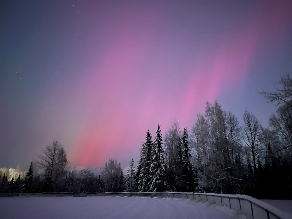
Discover how wildlife and people adapt and thrive in Alaska’s most extreme season. Explore the science behind the northern lights, the vital role of ice, the mysteries of hibernation, and the ways communities come together during months of deep cold and long darkness. From frozen rivers to aurora-lit skies, this talk blends science and storytelling to reveal the unexpected beauty, richness, and resilience of life in one of Earth’s most demanding environments. Available here.
StoryMaps Featuring the Aerial Odysseys of Migratory Birds
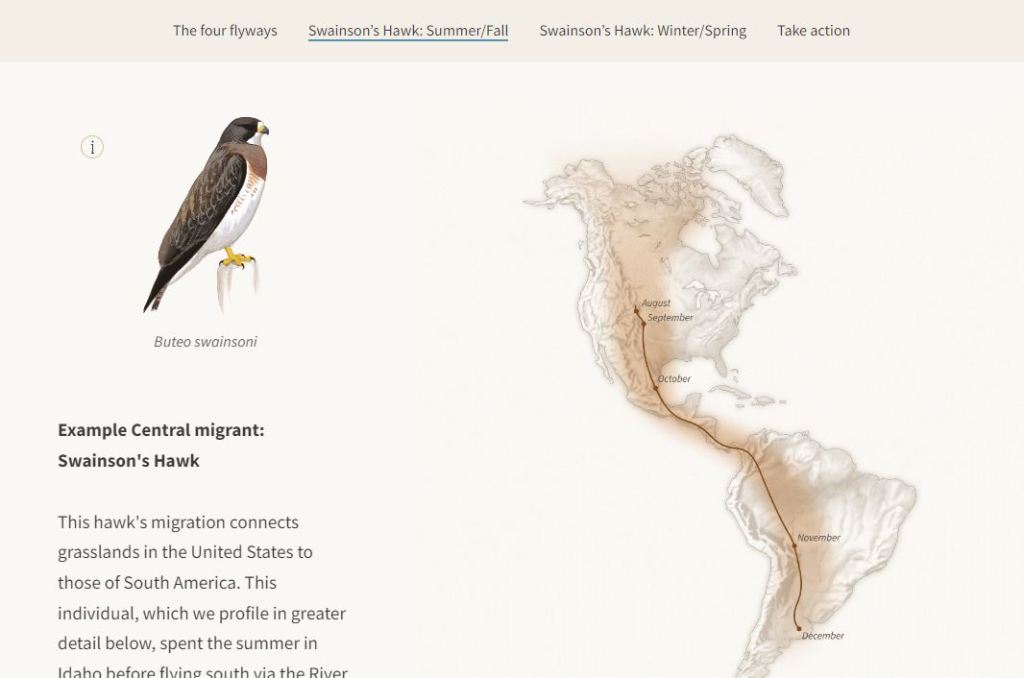
Authored the story behind Aerial Odysseys: Bird Migration in the Americas in partnership with the StoryMaps team at Esri. This was co-launched with the Bird Migration Explorer to bring attention to the heroic migrations that individual birds make and tell a more indepth story about the journey of Diego the Swainson’s Hawk. The StoryMap was selected by Esri as one of the Top Ten Stories of 2022 and is now featured in Allen Carroll’s new book Telling Stories with Maps.
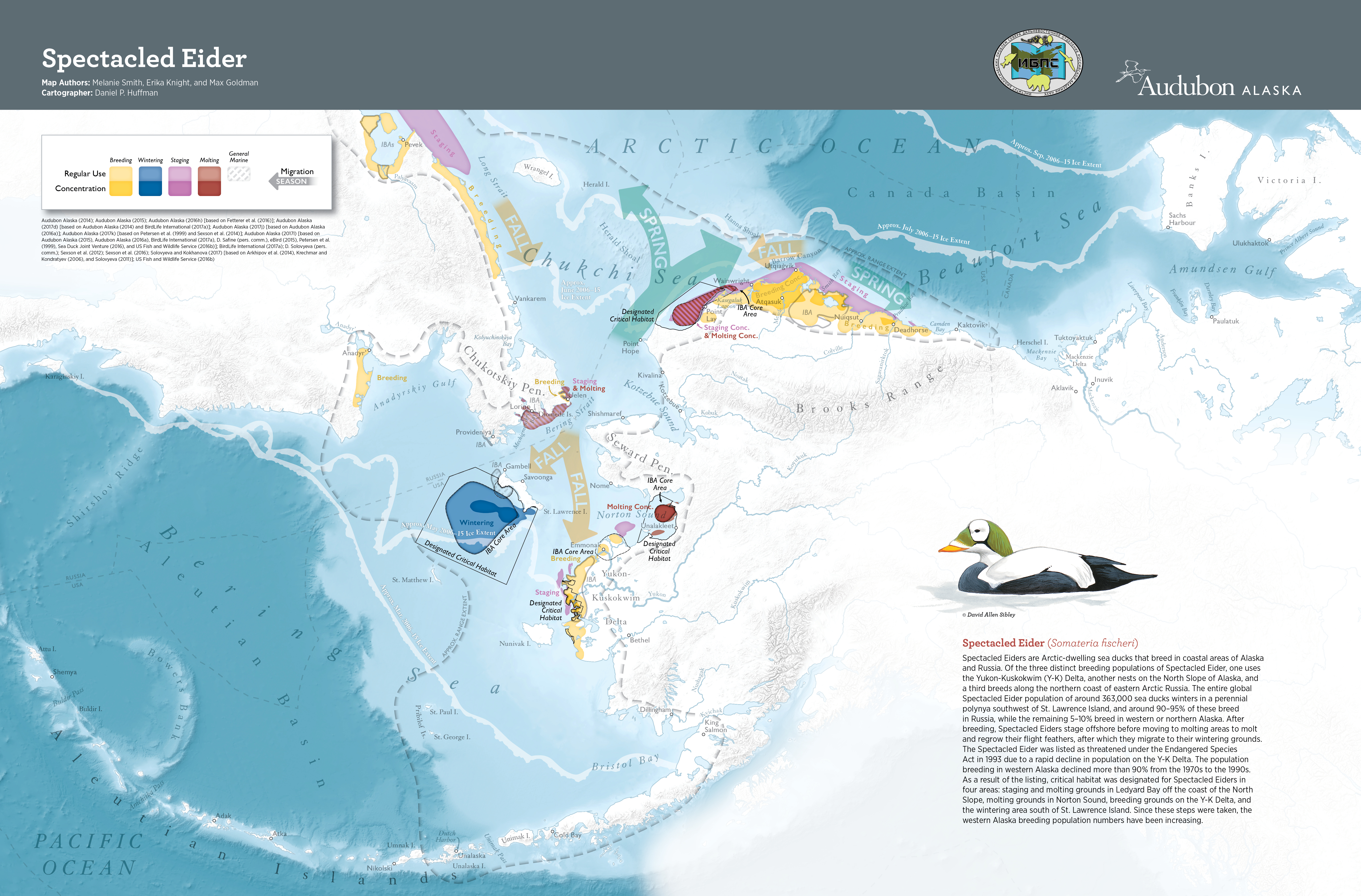
Lead editor/author of the Ecological Atlas of the Bering, Chukchi, and Beaufort Seas, a peer-reviewed, transboundary synthesis of spatial data, wildlife ecology, and conservation issues. This 2nd edition atlas was completed in cooperation with numerous US, Canadian, and Russian agencies and organizations. The atlas won best in show and other cartographic awards at Esri’s 2018 User Conference. This and the earlier 2010 version of this atlas have been widely used by state and federal agencies for planning, preparedness, and response applications. The associated interactive mapping portal provides deeper access to the vast data included in the atlas.
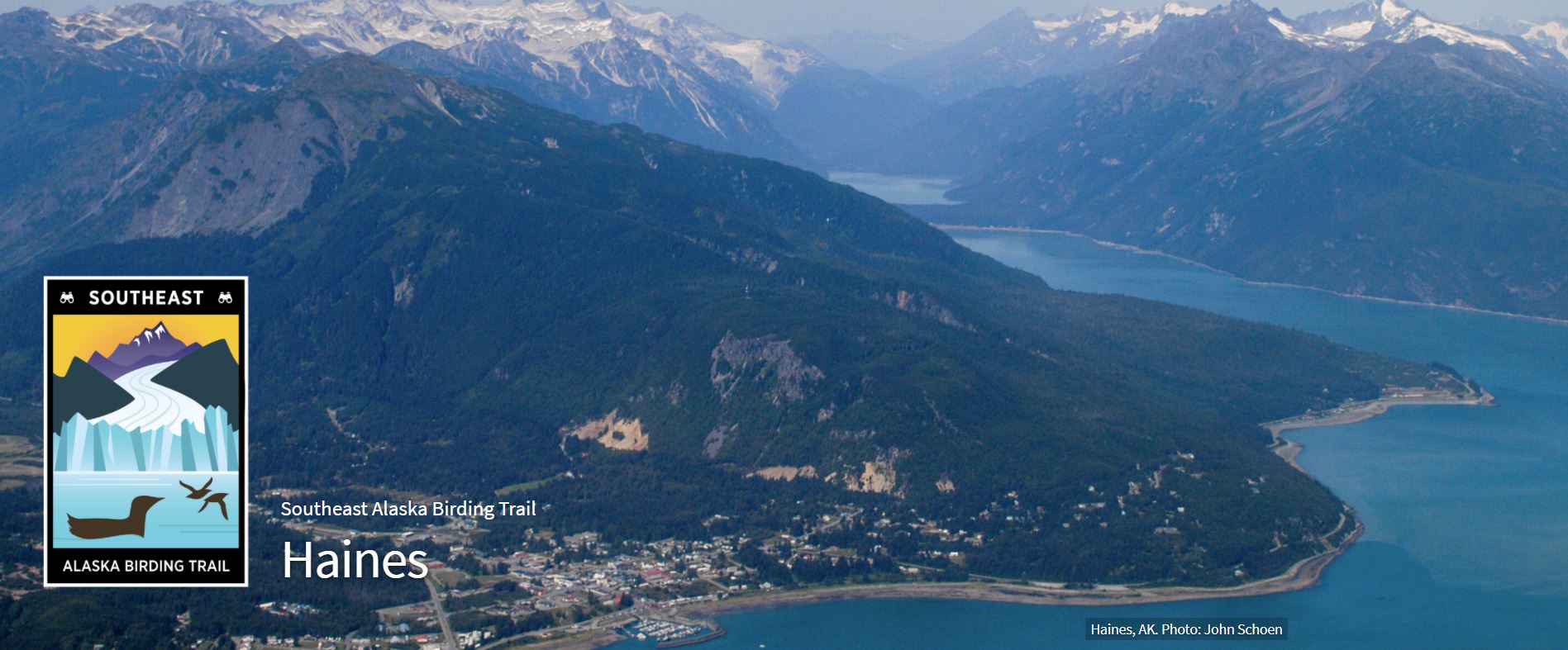
Southeast Alaska Birding Trail
Concepted and developed the Southeast Alaska Birding Trail. In partnership with the US Forest Service and Juneau Audubon Society, the trail attracts local to international birdwatchers to key migratory sites for birds, providing conservation engagement opportunities while contributing to the local economies of Alaska’s small, formerly timber-dependent communities.
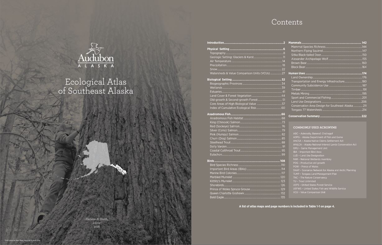
Ecological Atlas of Southeast Alaska
Lead editor and cartographer for the Ecological Atlas of Southeast Alaska, a resource that steps through the physical and biological setting of the region, including maps of the distribution of fish, birds, mammals, and human uses, with information on conservation needs.
M. Smith. A Hemispheric Perspective on Local Bird Migration. 2024. In Whale & Bird Fest, Craig, AK.
M. Smith. Bird Migration Explorer. 2023. In Smithsonian Movement of Life, Washington, DC (remote). Available here (55:45).
M. Smith, C. Wilsey, M. Carbone, E. Knight, and N. Henry, 2023. Sustainable World Showcase: Journey of the Bird Migration Explorer. In Esri User Conference, San Diego, CA.
M. Smith, J. Mahoney, E. Ashcroft, and N. Henry, 2023. Amplifying a cutting-edge product with tech partnerships. In NTEN Nonprofit Technology Conference, Denver, CO.
M. Smith*, 2022. Harnessing the power of GIS for bird conservation (keynote presentation). University of Pennsylvania GIS Day. Philadelphia, PA. Recording available here.
M. Smith*, 2021. A geospatial platform to connect birders with migration and conservation. In Esri User Conference. Recording available here.
M. Smith*, 2020. A geospatial platform for hemispheric bird conservation. In GIS Day: Low Budget, High Fidelity. Recording available here.